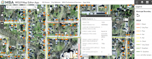
In 2021, the City of Ripon decided it was time to upgrade and streamline its database of community infrastructure, which until then, was still documented in outdated CAD drawings and hard-copy wall maps. In response, the MSA GIS team developed a custom new ArcGIS Online site for the City along with GIS applications, dashboards, and methods to streamline data collection, organization, and long-range asset management.
A key goal of the project was to simplify the inventory of local roadways and pavement conditions to meet reporting requirements set forth by the Wisconsin Department of Transportation (WisDOT). These requirements include conducting a full assessment of public roads and rating the surface condition of each based upon the Pavement Surface Evaluation and Rating (PASER) system established by the University of Wisconsin-Madison — then submitting the findings to WisDOT on a biennial (every odd-numbered year) basis.

MSA first configured an app based on Survey123 to manage pavement inspections and digitally track conditions, then trained City staff on how to utilize the application out in the field via tablets, iPADs or other mobile devices. MSA also customized a visual reporting tool called a dashboard to help staff easily track inventory progress, evaluate data collected, and review road-specific PASER ratings in real time — all helping the City meet DOT reporting requirements as well as prioritize future reconditioning or reconstruction projects.
Along with the pavement rating solutions, the City of Ripon also received new GIS applications to manage community utility systems, tree inventories, permitted parking lots, TIF districts and voting precincts. GIS has become an integral tool used across City departments, providing staff members with immediate, accurate information about community assets to guide them in future planning, budgeting and decision-making.
