In today’s digital age, the way we share and access information is rapidly evolving.
Communities are all well aware of this as they work to incorporate GIS into daily workflows, data management, and public engagement efforts. For many, traditional hard-copy plans have long been the standard for a comprehensive plan. As we explore ways to increase accessibility and usability of plans, offering integration of digital tools like ArcGIS StoryMaps to improve and streamline access to plan material can enhance the planning process along with implementation and long-term results.
Over the past several years, MSA’s urban planners and GIS specialists have collaborated with clients to provide customized online comprehensive plans. Historically, we’ve relied on the power of StoryMaps to provide 24/7 online access to project materials and have evolved the tool into authoring online plans for clients — either as the updated comprehensive plan itself or as a great supplement.
Here we explore several benefits of incorporating ArcGIS StoryMaps into your comprehensive planning process, and why perhaps going to a StoryMap online plan as your stand-alone planning document can be a game-changer.
Enhanced Accessibility and Engagement
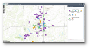
ArcGIS StoryMaps transform static documents into interactive, visually engaging narratives. This digital format makes it easier for a wider audience to access and understand complex planning information. Residents, stakeholders, and decision-makers can explore maps, images, and multimedia content, making the planning process and any final deliverables more inclusive and engaging.
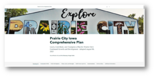
Click on the image below to see a working StoryMap created for Prairie City’s comprehensive planning efforts:
Real-Time Updates and Flexibility
Unlike hard-copy plans which can quickly become outdated, ArcGIS StoryMaps allow for real-time updates in planning documents. Editors can easily amend content to reflect new data, policy changes, or community feedback. This flexibility ensures that your comprehensive plan has the ability to stay current and relevant as your community approves updates by amendment.

Improved Visualization and Analysis
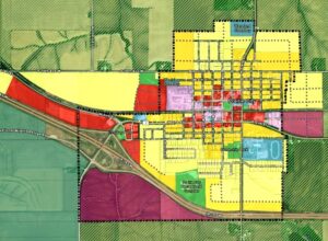
ArcGIS StoryMaps leverage the power of GIS to provide detailed spatial analysis and visualization. Planners can overlay various data layers such as demographic trends, land use patterns, and environmental factors to create a comprehensive picture of the area at hand. This enhanced visualization aids in better decision-making and more effective communication of complex concepts.
Cost-Effective and Sustainable
Utilizing ArcGIS StoryMaps to communicate during the process of updating a comprehensive plan allows planners to build the final deliverable in an even more efficient manner. The efficiencies realized can stretch communities’ budgets and resources to add even more value to the planning process. Perhaps an additional pop-up meeting at a community event can be facilitated with resources instead of 30 pages of static demographic data that is out of date before the process is over? Or perhaps a special section focused on revitalizing your downtown area (as opposed to multiple hard-copy formatted appendices) can be replaced with links or online maps?
Additionally, producing and distributing hard-copy plans can be costly and resource-intensive. ArcGIS StoryMaps offer a cost-effective alternative by reducing the need for printed materials. Additionally, the digital format supports sustainability efforts by minimizing paper usage and the environmental impact associated with printing and distribution.
Enhanced Collaboration and Transparency
ArcGIS StoryMaps facilitate collaboration among planning teams, stakeholders, and the community. The interactive platform allows for easy sharing of information and feedback, fostering a transparent planning process. Stakeholders can contribute insights and suggestions directly through the platform, ensuring that diverse perspectives are considered. Accessibility on any device is highly effective and easy to configure.

Data Preservation and Distribution
Digital StoryMaps provide a durable and easily accessible archive of historical planning data. Unlike physical documents that can degrade over time, digital records remain intact and can be referenced or updated as needed. This preservation of historical data is invaluable for long-term planning and analysis.
Additionally, many communities without dedicated planning staff have public works departments that are already utilizing ArcGIS Online and have annual subscriptions that provide access to build and edit ArcGIS StoryMaps. When that is the case, MSA planners and GIS specialists can work with communities to set up the online plan on the community’s ArcGIS Online account — and, after project completion, the community can review and amend the plan with ease.
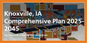
Click the image below to see an ArcGIS StoryMap developed for the Knoxville Comprehensive Plan:
Conclusion
While traditional hard-copy comprehensive plans have their place — and indeed, some jurisdictions require hard copy plans — the integration of ArcGIS StoryMaps offers numerous benefits that enhance the planning process. By combining the strengths of both formats into an online plan, planners can create more accessible, up-to-date, and engaging comprehensive plans that better serve communities. Embracing this digital tool is not just a step forward in technology but a leap towards more effective and inclusive urban planning.


