Clintonville, Wisconsin, is a small city with a large commitment to managing, maintaining and improving the useful life of their community infrastructure. Established in 1855 and with a current population just under 5,000, Clintonville is setting the standard for forward thinking and implementing the latest in GIS and asset management technologies to ensure their assets remain in solid working condition for future generations.
In 2016, MSA assisted the city with the implementation of a robust asset management system utilizing ArcGIS. This system allows for water, wastewater and electric utilities—as well as public works departments—to use application-based methods as a way to manage infrastructure. Esri’s Collector for ArcGIS app assists employees in the field as they locate utilities or inspect a variety of structures on site. This is convenient for tracking important maintenance tasks such as water valve exercising, mainline jetting (removal of clogs/debris) on sanitary sewer lines, manhole inspections or electric pole upkeep. The app is also useful in recording necessary emergency repairs such as water main breaks, sanitary or storm water back-ups and electrical outages. Staff are able to take notes while on-the-go, denote work that is incomplete or flag areas that need further attention. The data can be referenced by any user—or multiple users—at any time or location.

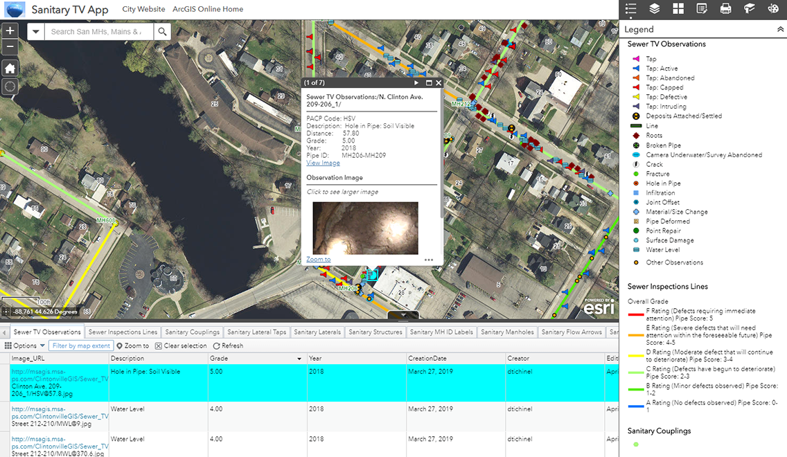
To further bolster their asset management ability, Clintonville elected to televise their entire sanitary sewer system. This opens the door for a variety of system-wide tracking and detailing. Staff are able to view televising reports and defect images at the exact location where they were observed. Holes in piping, evidence of roots in the line, cracks or fractures are mapped in GIS along with the severity of defectiveness and the type of materials used. In addition, sewer lines can be assigned a grade ranging from A to F, allowing city officials to better prioritize and prepare to fund needed repairs.
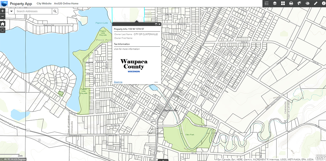
GIS applications have also been set up for use by the citizens of Clintonville. A property mapping app, streamed from live County map services, easily links users to information regarding parcel maps, addresses, plat and deed records, ownership, real estate taxes, property values and documents related to deeds, liens or payments.
All of these investments in GIS are proving that small changes can truly make big, and lasting impacts upon a community. It is our pleasure to continue to partner with the City of Clintonville and we applaud them for their dedication to a strong and sustainable future.

