As communities begin the annual task of preparing their capital improvement plans, the first question that comes to mind is, “Where to begin?” Some communities have all their historical information available and easily accessible for planning. Others have limited information, information that is on paper, in someone’s head or in a file cabinet deep in storage. None of this data is helpful when it comes time to start the planning process if it is not compiled in one easily accessible place.
GIS is a powerful tool to that can be used to bring all of this important data together.

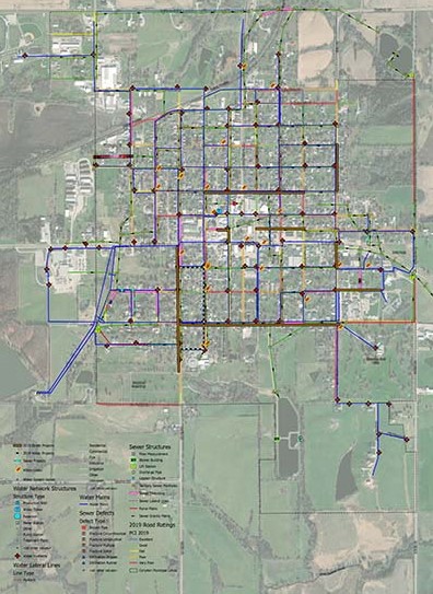
Most people only think about the obvious GIS use – the physical collection of utility data inventory. However, there are so many other ways that GIS can assist municipalities with planning. Once a community has their base mapping completed in GIS, additional layers can be added for virtually any other data that the City has on hand that needs to be recorded and inventoried. Examples of this include water leak locations, sewer televising data, pavement evaluation data, utility condition data, and associated photos. Each of these items can be color coded based on condition and can have labels indicating specifics such as the size and type of piping that may need updating or replacement. The compilation of these layers of data greatly assists with prioritization and planning efforts, saving communities time and money.
Case study – Corydon, Iowa
The City of Corydon in southern Iowa serves as a great example of how a community can utilize GIS systems to evaluate current pavement and utility infrastructure and most accurately plan for future needs.

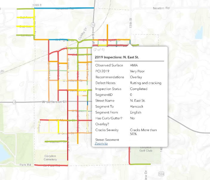
MSA was asked to develop a series of GIS mobile inspection tools and web applications specifically for Corydon. The first was a GIS pavement condition mobile app, used to perform standardized pavement condition inspections and ratings. Existing pavement conditions were evaluated based on Iowa State University’s Center for Transportation Research and Education (CTRE) Pavement Condition Index (PCI), a published 2-year cyclical rating scale of excellent to very poor. A visual observation of the pavement condition was done to evaluate if the pavement was still at the published CTRE level, along with rating of pavement attributes with the app and uploading of photos to the GIS system from the field. This information was paired with previously developed system maps and databases to provide more specific details and was used to track critical steps taken, dates scheduled or completed, and current-state conditions for City streets, sewer and water systems.

MSA then developed a map layer to track system failures and breakage, assisted by reviewing City records and interviewing City staff to document poorly performing assets. The overall system was supplemented with layers to track previously completed improvement projects including project dates, improvement types and hyperlinks the to the scanned project plan itself.
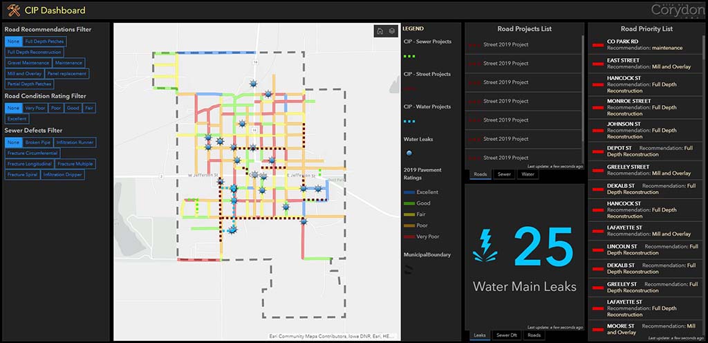
The results of these GIS data collection efforts were compiled into an online Dashboard for the City, an easy-to-use snapshot of the metrics of street, sewer and water system conditions with associated rankings, areas of concern, and a recommended priority list.
MSA is currently in the process of generating a custom weighted City Priority Ranking app for all road segments to assist with Corydon’s capital planning, operations and maintenance, and budgeting efforts. The app will include proposed projects, types, details and estimated costs. This system will leverage ArcGIS Online tools and asset data managed in the organization’s ArcGIS Online account. This dynamic app will make the Capital Improvement Plan (CIP) available to any City staff member at any time, providing them with real-time access to critical data as well as the ability to add comments as necessary as the CIP process progresses.

When leveraged to its full extent, GIS can be a powerful capital planning tool by combining all of the requisite information and data in one location to review during the planning stage. It allows for more comprehensive and interactive discussions between municipal staff, utility departments and engineers to determine what the community’s priorities are and which projects should be moved to the forefront of the CIP.
Is a GIS capital improvement planning something your community would find useful? Start a conversation with MSA today to get the process started.
