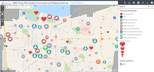
Where is your community on the map when it comes to providing quality park and recreational facilities?
Not on the map at all? Somewhere down a gravel road without cell signal or GPS? Or maybe you’ve hit a few checkmarks, but your plans could use a refresh or update.
Whether you have a solid portfolio of individual park master plans in place, a comprehensive outdoor recreation plan (CORP), collection of napkin ideas for park improvements — or nothing whatsoever, it’s not too late to reorient your position and put yourself back on course toward providing park and recreational amenities your community can be proud of.
There isn’t a one-size-fits-all solution to park planning and each community has a unique set of goals, budgets, and existing properties to work with. However, no matter how small the need or large the dream, soliciting input from community members and developing some sort of planning document provides the best chance of successful funding and implementation.
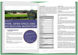
Comprehensive Outdoor Recreation Plans (CORP)
The CORP is the de facto all-inclusive document for community park and recreation planning. Different states may call it by different names: CORP, park systems plan, or park and open space plan, to name a few. Whatever the nomenclature, a CORP is the most exhaustive means to review existing conditions, identify needs and deficiencies, develop goals, make recommendations, and develop a long-range guidebook to reach those goals. Developing a CORP is also immensely beneficial in applying for and securing funding. In fact, some funding sources require CORPs in order to meet basic eligibility requirements for the program.
Park Master Plans
Developing master plans for singular parks or for an entire parks system is similar in methodology to that of the CORP. The difference lies in the amount of design detail and conceptual rendering work that can be incorporated into the process. And how individual parks feed into a broader, more holistic sense of community.
Here, a professional planner might work in tandem with park and recreation engineers or landscape architects to develop concept plans based off citizen and municipality input. Many times, these plans incorporate character images for possible park amenities, trail routes, park shelters and additional landscape design — created to help community members more accurately visualize what the future of their park/s might be. Supplementary renderings, from hand-sketched to computer generated, may be included to clarify the design intent. Aerial drone photographs are an excellent tool for capturing existing conditions and can be used as a foundation from which to render design ideas on top of.
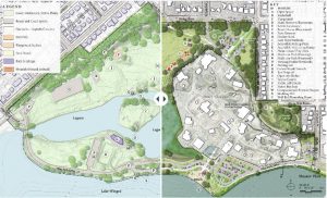
Follow this link to an interactive StoryMap created for Vilas Park in Madison, WI.
Similarly, StoryMaps are a fun and interactive means to explain the planning philosophy and process. Based on the ArcGIS Online platform, StoryMaps are modifiable digital maps of a project site, with the ability for designers to overlay design ideas for citizens to view. They can also provide step-by-step virtual tours through a property to describe existing conditions or future concepts for certain park amenities — all readily accessible via desktop, tablet, or mobile device.
Design Development and Construction Documentation
When it’s time to develop actual designs for a park, planners, surveyors and landscape architects work together to gather site topographic, geotechnical, soil, historic, environmental and archaeological information to ascertain parameters for design — such as whether they need to work around existing wetlands or be cognizant of important historic or protected areas. Schematic design takes concept plans and applies them on top of a topographic survey. Here, a designer can modify the concept plans to match the precise contours and grading of a property — a step that can greatly save on time and cost during the construction phase. At this phase, 3D renderings and models can also be employed, transforming designs into what feels like a real-life experience, with the ability to create virtual walk-throughs of a proposed project in order to work the master plan concepts into the actual site topography. These finishing touches are the catalyst to the development of final plans and specs, which are then prepared for permitting, bidding and construction.
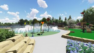
3D rendering created for the transformation of Fireman’s Park in Verona, WI.
Community Engagement
Community engagement is key to developing all types of park and open space plans and can help generate excitement, make a meaningful impact, include a wide demographic of ideas and elicit public buy-in and support. First-hand feedback from the people who live, work and play in the community is what forms the foundation of any successful park plan. After all, these are plans for the people who reside in the community. Any development of a plan without their input is a mismanaged use of time and funds.
There are many excellent means to solicit input from community members and planning professionals must offer a diverse variety of options, created to reach people with a wide spectrum of accessibility, availability, and time.
Community Input Surveys. Surveys are a simple baseline for public engagement. These can be made available online, distributed via mail, or a combination thereof. Surveys collect a wealth of vital information about how people are currently using park and recreational amenities, at what level they are participating in recreational programming either locally or regionally, and whether or not their needs are being met.
Crowdsource mapping. A slightly newer tool in the public engagement toolbox, crowdsource mapping is a fun and interactive way for citizen to pair their opinions and ideas with actual geographic locations on a map. Utilizing ArcGIS Online — a real-time GIS mapping platform — participants can simply click on a location on the map, whether neighborhood, park amenity, nearby intersection, or trail, and add a comment or upload a photo to add their feedback. This can be helpful for specifically locating an area of opportunity or concern, such as where more lighting or safety features are needed, which part of a park needs improvement — or which part is loved — or where sidewalks, intersections or recreational assets do not meet Americans with Disabilities Act (ADA) compliance.
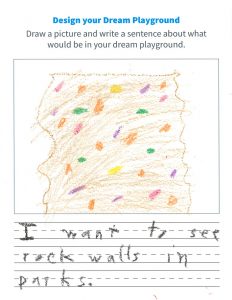
Pop-up Events. Pop-up events are the perfect means to meet citizens where they are. Tied to existing community events or celebrations, these tents or booths are great for gathering feedback from those who may not otherwise attend a public meeting or have time to participate in a survey. Providing activities for all ages, particularly kids, will also collect input from some of the most frequent users of community park and recreational assets. What is their vision for a park? What types of activities sound exciting to them? The more input, the better the result!
Funding
Once the community’s existing needs and wants are identified and a final CORP or park system plan is developed, it’s time for a funding checkpoint. A well-constructed comprehensive park plan will help community leaders identify top goals and outline steps toward implementation. Those waypoints then serve as guides to ascertain which grant sources or funding programs should be pursued — and when. There are several federal, state, and private funding opportunities for park and recreational improvements. Many of these are competitive and require a level of planning and public involvement already accomplished through the CORP development. Having a CORP or equivalent plan in place can set a community’s funding application apart in the competitive review process.
On the Map
Planning, designing and implementing parks should be fun! With the right tools, documents, and support — it can be. There is no better time than the present to get started. Place your community on the map as a destination for quality recreation and for positively impacting generations to come.
Ready to get started? Contact an MSA planner near you and let’s work together to achieve your dreams.
![]()
![]()
“Chart Your Course to Park Implementation” is also available as a webinar! Click here to view a recording of the presentation from November 29, 2022.
