The English adage, “A picture is worth a thousand words,” could not hold more truth than in the world of architecture and engineering. Historically, the “picture” was a set of drawings intended to communicate a design intent or to provide a set of instructions for how to construct a building, roadway or bridge. While some of this still holds true today, as designers, there are better ways to communicate and collaborate with clients, stakeholders, the public — and ultimately — the contractors and construction engineers building our projects – by utilizing the sophistication of 3D models and visualizations.

In some cases, there is a large emphasis on the visualization of the completed model as it portrays the “finished product.” While there is certainly value in that, the real value emerges throughout the design process and provides a step-by-step guide to the evolution of the design itself. This is an excellent opportunity for project champions and elected officials to illustrate to funders, constituents or the general public what improvements are being made. This can take place during public involvement meetings so that local residents can see the changes happening near their property or neighborhood, or during a progress meeting to communicate how engineering design or safety standards function in 3D.
Intuitive roadway design
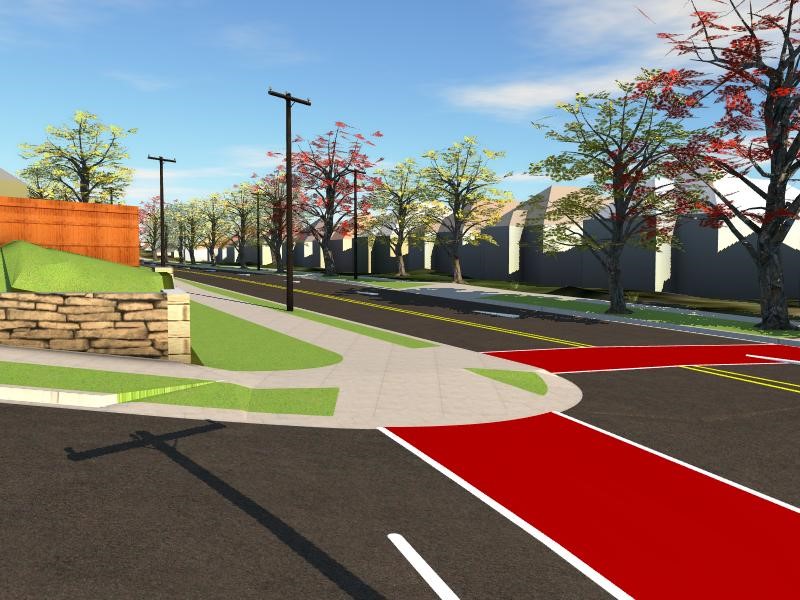
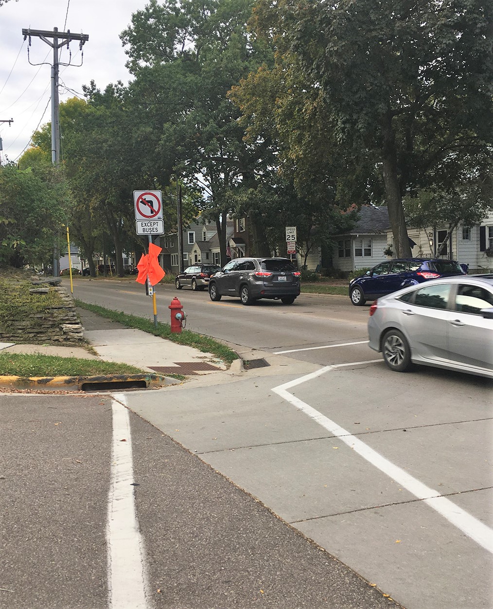
For street and road projects, using visualization means you do not need to create a detailed model for an entire corridor, but rather, narrow in on where opportunities exist to better facilitate design decisions. A perfect example of this process is currently underway in MSA’s design efforts for Atwood Avenue in Madison, Wisconsin, where engineers are able to utilize visualizations to better facilitate intersection design decisions. In this instance, the intersection had been receiving a lot of public feedback due to poor sight distances and subsequent safety concerns. Simply drawing sight lines on paper does not fully illustrate what the average roadway user would see when stopping at this intersection.

By using a design model, engineers are able to quickly provide an enhanced graphic of the proposed condition in comparison to the existing condition, simulating a realistic version of what the new sight lines and open views will be. By using this technology, a decision to proceed with the intersection upgrade was quickly made, saving countless hours of time, meetings, and back and forth discussions that would have taken place by simply using 2D images to communicate.
3D modeling for storm sewer upgrades
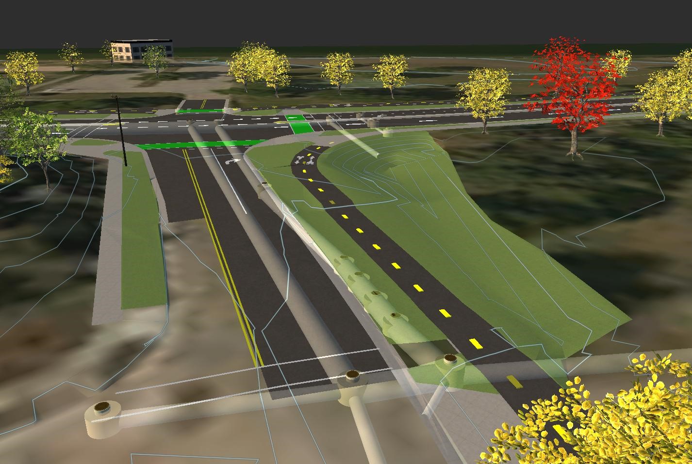
Another example of MSA using design technology for municipal infrastructure projects also occurred in Madison after a major flooding event in 2018. The city experienced multiple road closures due to extreme rain and flooding. So much so, that a local ordinance was changed to design portions of stormwater sewer to handle the capacity needed for a 100-year storm event, rather than the preexisting 10-year standard. This meant a substantial investment in the upsizing of storm sewer piping underground as well as the need for increased overflow capability to ensure the water could collect and properly drain through the storm sewer system. This change would impact parkland in the community, however, as parks provided the perfect opportunity for storm sewer detention areas. There was obvious concern for what this might look like and a desire to ensure the end product wouldn’t look like large drainage ditches in the parks. Engineers again were able to provide a detailed visual example of the proposed storm sewer infrastructure and associated grading to meet the needs of the ordinance. This provided the Madison Parks and Recreation Department confidence that the impact would be less abrupt or impactful and allowed them to visualize in detail what would have otherwise been imagined based solely on discussion or basic engineering contours.

A more sophisticated design future
Utilizing new technology and more sophisticated design tools to create plans and deliverables can very easily and specifically enhance and more effectively communicate design intent to clients and communities. This allows for a more efficient project timeline and allows designers to gain essential feedback and buy-in from stakeholders, funding agencies and the public. It has been said that visualization is daydreaming with a purpose. It has also been said that when you first visualize, you then materialize. What better way to dream big and deliver sound solutions than with the aid of today’s best design technology.
