An ounce of prevention.
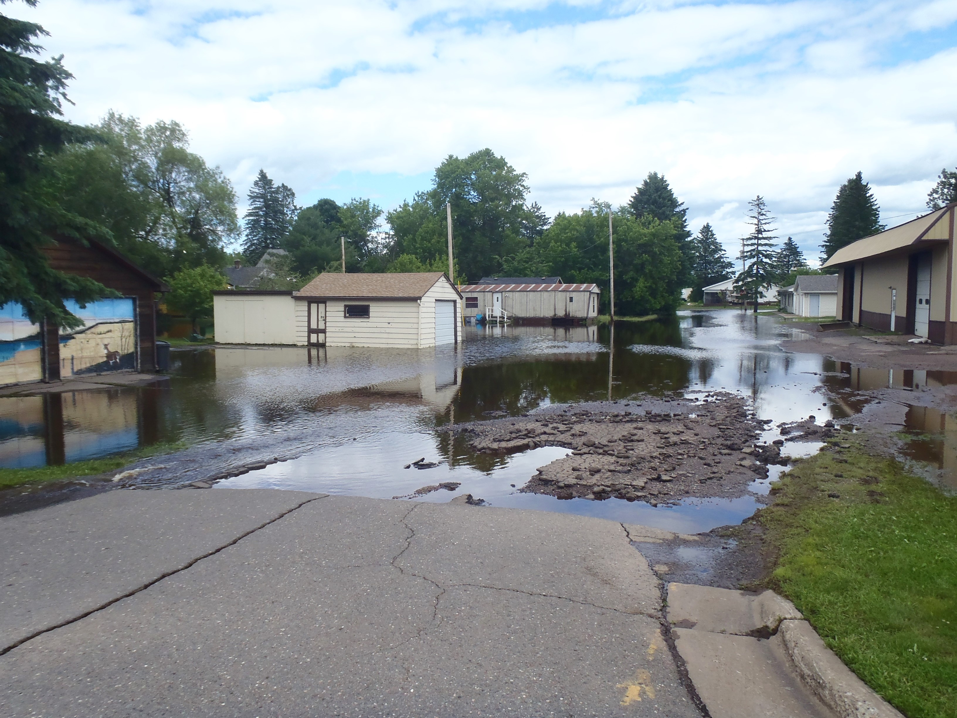
While flooding generally occurs when excess water from snow melt or rainfall accumulates and overflows onto a river bank or adjacent floodplain, flooding can really occur anywhere – even miles away from a water source. In years with above-average snow accumulation or rapid thaw, it is especially important for community leaders to be prepared for all that spring brings.

Developing a Flood Emergency Plan.
A Flood Emergency Plan (FEP) defines the roles and responsibilities of all parties involved in flood preparation and responsiveness efforts. Coordination and communication between emergency services, local authorities, state and federal agencies, and other local organizations is critical to the successful implementation of a FEP. A well-executed FEP will greatly reduce the risk to life, health, and the damage of community resources or infrastructure as caused by flooding.

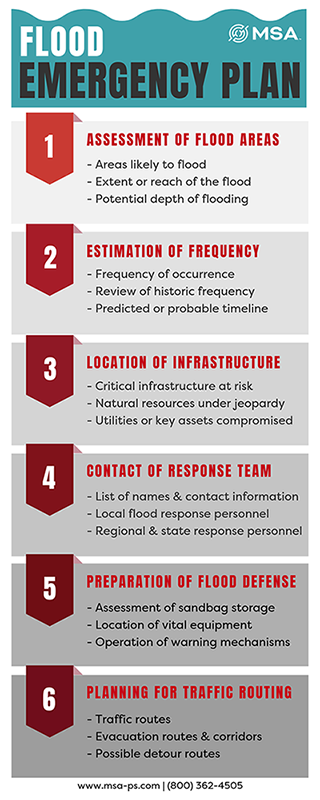
What should a Flood Emergency Plan include?
- Assessment of areas likely to flood and the extent and depth of flooding.
- Estimated frequency of occurrence (both historical and predicted or probable).
- Location of critical infrastructure at risk.
- Location of flood defense resources (equipment, sandbags, etc.).
- Names and contact information for local, regional and state flood response personnel.
- Traffic and evacuation routes and corridors, potential detours.
- Warning mechanisms.
Hazard analysis and identification.
Hazard identification requires a knowledge and understanding of the extent and degree of flood risk present in the area. For this, a community will need access to hydrological information, historic and predictive flood maps, and knowledge of the community resources and infrastructure that are at the greatest risk.
Most communities that participate in FEMA’s National Flood Insurance Program also obtain a FEMA flood map that helps identify areas of concern. However, the maps typically do not identify every potential flood hazard that may exist within a community. Important elements such as seasonal changes in condition, maintenance, and changing runoff conditions due to urbanization are typically not reflected in flood maps. Seeking out a source of supplemental flood information to complement the FEMA map is highly encouraged.
Application of flood modeling technology.
This is where the employment of a dedicated water resources professional comes into play. Advanced technology such as 2D modeling software simulates potential flooding scenarios. With it, we are able to digitally model a community’s floodplains, drainage systems and topography, then run a virtual trial to see how flood waters might flow through—and impact—a variety of infrastructure, neighborhood and natural features within an area.
In addition, the software can be used to create more advanced floodplain and hazard maps as well as dynamic, full-motion animations to help a client or community most wholly visualize potential areas of concern or opportunities for improvement, before they are necessary.
A pound of cure.
The combination of a comprehensive Flood Emergency Plan, advanced floodplain mapping and thorough hazard identification won’t prevent a flood, but it will certainly minimize the impact. These things, in addition to a thorough flood preparedness campaign for the residents of a community, will instill a level of confidence in being best prepared for any worst-case scenario.
Flood preparedness also helps mitigate the high costs associated with natural disasters and saves on critical resources. In early 2018, the National Institute of Building Sciences (NIBS) released a report revealing that every $1 invested in disaster mitigation saves society $6 in disaster recovery. It also saves lives, and that is what matters the most.

Our professionals can help.
For more information about how your community can be best prepared for potential flooding events, contact us today or get in touch with your local MSA Client Liaison.
