Urban planning is a complex endeavor that shapes the future of our cities.
As our world becomes increasingly interconnected and data driven, planners must harness innovative tools to make informed decisions. Enter Geographic Information Systems (GIS) – a technology that revolutionizes urban planning by providing spatial insights, enhancing collaboration, and empowering more sustainable development practices.
Collecting Public Input & Encouraging Civic Engagement
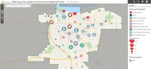
GIS enables planners to engage with the community more effectively. By creating interactive maps and web applications, planners can solicit public input on proposed projects, zoning changes, and infrastructure improvements. Citizens can mark locations of concern, comment on proposed developments, and participate in virtual town hall meetings. This democratization of information ensures that urban planning decisions reflect the needs and aspirations of the people who call these cities home.

GIS can also help encourage volunteerism and civic engagement. Custom apps can be developed for adopt-a-road, adopt-a-hydrant, or neighborhood clean-up initiatives — fostering a sense of ownership and belonging among community residents.
Transforming Online Zoning Information
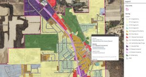
Zoning regulations provide the spatial framework for urban development. They dictate land use, density, setbacks, and building heights. Traditionally, zoning ordinances and maps were static, paper-based documents. However, GIS transforms these maps into dynamic, digital tools drastically changing how we can visualize different urban environments. Planners can overlay zoning layers with other data — such as transportation networks, environmental features, and demographics — to visualize the impact of zoning decisions.
Online zoning information portals allow developers, residents, and businesses to explore zoning regulations, understand land use restrictions, and make informed choices. Presenting this information in an easily accessible online format can reduce time spent on information requests and help improve the application process.

Informing Land Use Decisions
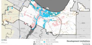
GIS provides a more holistic view of urban landscapes. Planners can analyze land suitability, environmental constraints, and infrastructure availability when making future land use decisions. For instance:
Site selection: GIS helps identify suitable locations for schools, parks, hospitals, or public services based on proximity to existing amenities and population distribution.
Environmental impact assessments: Planners can assess the effects of proposed developments on natural resources, wildlife habitats, and water bodies.
Transportation planning: GIS models traffic flow, identifies congestion points, optimizes transit routes, and can assist communities in ensuring their public rights of way are ADA compliant.
Emergency response: During crises, GIS aids in locating evacuation routes, emergency shelters, and critical infrastructure.
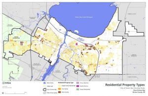
GIS can also help collect and visualize community housing data. Maintaining accurate data and presenting it effectively can help communities make important choices about when, where, and how to invest in housing infrastructure. Analyzing and presenting spatial data can be a valuable tool when completing capital improvement plans and grant applications. In short, GIS can help put community data to work for you to make decisions in a real, meaningful, and practical way.

Conclusion
In this digital age, urban planning cannot afford to be static. GIS empowers planners to create vibrant, resilient cities. By collecting public input, presenting zoning information online, and informing land use decisions, GIS becomes a beacon guiding us toward sustainable, inclusive urban futures. Let us embrace this transformative technology and build cities that thrive for generations to come.

