Mobility matters. Within every community, the ability for people to engage with the places and faces they call home is critically important. This is achieved by making sure that the public can freely move throughout, travel between and access all public landscapes and services at their disposal. The most helpful means to reach this goal is by conducting a public right-of way audit and assessing how your community stacks up to the recommended PROWAG guidelines.
What are PROWAG guidelines?
The United States Access Board Public Right-of-Way Accessibility Guidelines, otherwise known as PROWAG, are the proposed guidelines for the design, construction and alteration of pedestrian facilities in the public right of way. Introduced in 2011, PROWAG offers guidance to state and local governments to ensure that all public sidewalks, pedestrian crossings, signals and facilities are readily accessible and usable by pedestrians of all levels of mobility, specifically those with disabilities.
PROWAG standards go hand-in-hand with the Americans with Disabilities Act (ADA) of 1990, which protects and provides equal opportunities for individuals with disabilities in all arenas of public life. They are instrumental for communities who are scrutinizing and upgrading their level of accessibility or drafting transition plans to meet compliance with Title II of the ADA, which specifically refers to public right-of-way areas and the requirement to make proper accommodations.
How do we define public right of way?

PROWAG defines right of way as “public land or property, usually in interconnected corridors, that is acquired for or dedicated to transportation purposes.” Think pedestrian access routes, pedestrian street crossings, curb ramps, detectable warning surfaces, accessible signal and push button heights, street furniture, transit stops and shelters, on-street parking spaces for mobility-assist vehicles, stairways, ramps, escalators, handrails, doorways, doors and gates. Anything pertaining to the passage through, obstruction of, or interference with a person’s smooth transition throughout public spaces.
How does a community become PROWAG compliant?
The first step toward compliancy is by designating an ADA coordinator or task force to lead the charge. These can be governmental representatives, municipal staff members, and/or professionals and individuals from local, regional or state disability organizations. If a local government has 50 or more employees, Title II requires the appointment of at least one responsible person to serve as an ADA compliance coordinator.
It also requires the adoption of a formal grievance procedure and action plan, which provides an avenue for citizens to file complaints about potential discrimination related to their disability, and defines what steps the governmental or public entity will take to document, file and resolve such complaints.
Similarly, an entity with over 50 employees will also need to conduct a comprehensive right-of-way audit throughout the community. This can be conducted by staff with proper training, or in partnership with a third-party consultant. All results should be publicly reported in a notice of findings.
After the audit has been conducted, Title II also calls for the creation of a Transition Plan to meet the most current ADA Standards for Accessible Design. The standards do change on occasion, so a municipality will need to be especially cognizant that they are auditing and planning for adjustments to meet the most recent requirements. A general outline for a Transition Plan includes a list of physical barriers that limit a person’s accessibility to programs, services, activities or transportation options; methods to remove the barriers; a schedule to get the work completed; and the name of the official(s) responsible for the plan’s implementation. Cost estimates or a list of funding sources is a common addition to the plan, although not a requirement. A finalized Transition Plan generally results in the creation of an Action Plan, with a list of tasks, timelines, and the names of parties responsible for completion.
How is a right-of-way audit conducted?
Historically, audits have been conducted in a boots-on-the-ground manner, with staff or members of the ADA team combing the community and analyzing all aspects of public right of way. This method requires meticulous mapping, photo-documenting, measuring and reporting of a variety of details about public infrastructure.
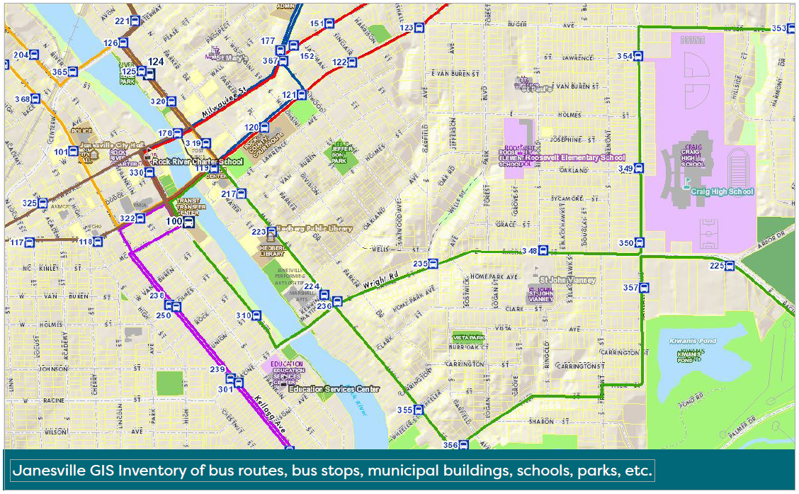
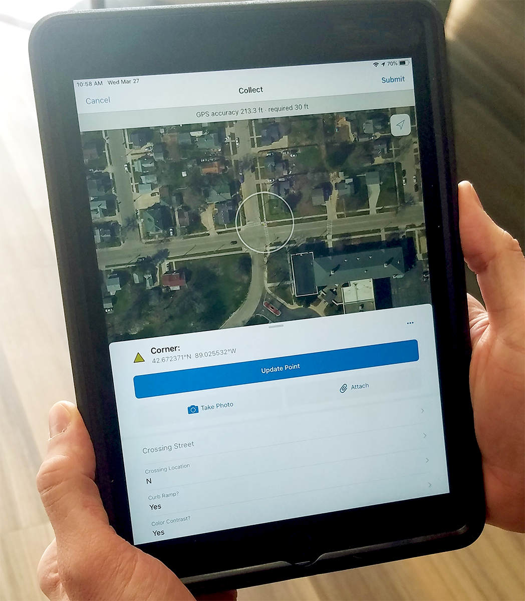
Today we can employ GIS and GIS-related technology. Employing an ArcGIS Collector Application for field auditing saves time, provides geographically precise location mapping and gives users the ability to create an instant, real-time database for future ADA asset management, planning and prioritizing.
Here’s an example:
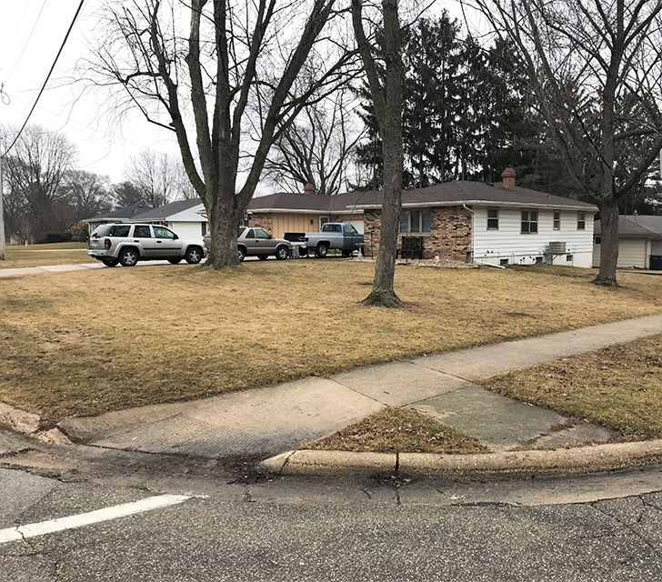
The City of Janesville, Wisconsin, was looking for a partner to assist with PROWAG compliance through an ADA audit of public right of ways within their community. The City reached out to MSA to assist with the effort, from audit integration through the creation of a Transition Plan. Their goal: assess conditions at 3,200 public intersections and 340 miles of municipal roadway including city curb ramps, sidewalks, transit stops, crossings, traffic signals, off-street sidewalks and trails.
Janesville was interested in being an active part of the auditing process, so the MSA GIS team configured a custom ArcGIS Collector App to be used by City staff in the self-auditing process. The app features a dashboard catered to collect and display information about the specific items Janesville wanted to target in their audit. In the field, the app is able to take a quick snapshot of the infrastructure and immediately upload to the dashboard, where it is marked for compliancy or non-compliancy. Condition tiers were established to help denote priority projects, with each individual element bucketed: tier one equaling largely or fully compliant points; tier two, substantially compliant; tier three, several elements non-compliant; and so on.
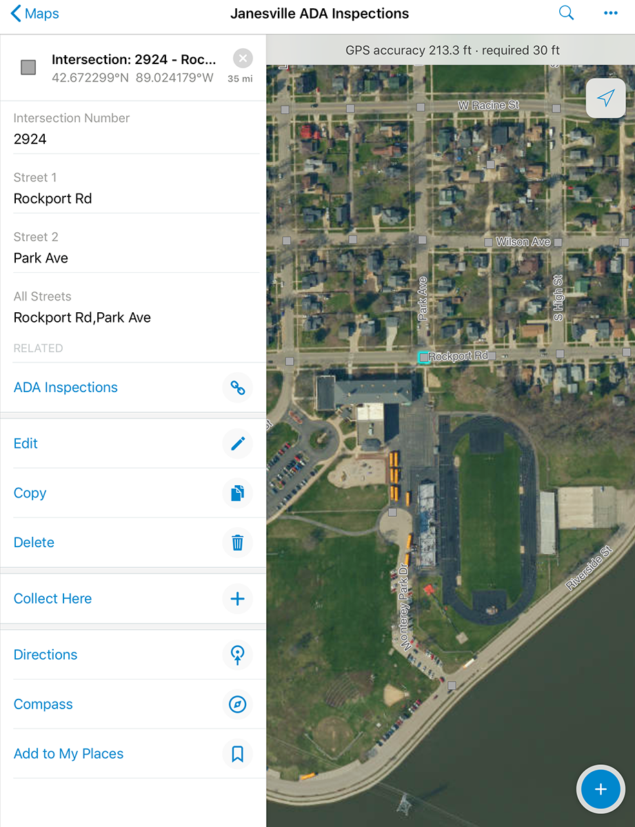
Data collected in the field is then merged into what becomes a new right-of-way database. This “living” map can be edited over time to track real-time progress of evaluations, upgrades, needs and completion dates. Locations can be recorded as precise GPS pinpoints, and pull-down menus on the app provide the user with PROWAG compliance needs and characteristics to assess during evaluation. Any photos taken in the field automatically sync up with the appropriate GPS location to create a custom pin on the map.
The app was tested to ensure it would fully interface with the City’s networks, as they would be the host of the new database. Training with City staff helped establish a confident comfort level with use of the app, assuring accurate and thorough assessments both in the immediate and long term.
Why is a GIS-assisted audit helpful?
Community audits to meet PROWAG and ADA compliance are stringent for a reason. Developing accessible facilities and right of ways is not only a legal requirement, but creates a better quality life for all people–regardless of age, ability or mobility.
Utilizing GIS to meet these ends provides an added level of accuracy that municipalities depend on to achieve PROWAG compliance and create the most equitable, maneuverable and enjoyable community for citizens and visitors alike.