It is difficult to analyze what can’t readily be seen. Such is the case in evaluating a community’s water distribution system. These complex networks of wells, pipelines, pumps, regulating valves and storage reservoirs operate largely underground or out of sight, yet are responsible for the safe delivery of one of the most critical elements in our daily lives: water.
Today, new software and technologies allow us to realistically visualize and investigate our water systems as never before. Enter: water distribution system hydraulic modeling. Water modeling is accomplished through the use of computer-aided design (CAD) based software to create simulations of how a water system functions. It allows modelers to assess current system behavior as well as potential future behavior and how infrastructure may react to changes in population, demand or proposed improvements.
Here, work done for the Long Creek Township Water Utility in Illinois demonstrates how modeled pressure contours change over a 24-hour period based on water tower levels, pump operating status and fluctuating system demand:
The advantages of water modeling are plenty
A water distribution system hydraulic model allows communities to gain a real-time view of how their distribution system works in the here and now. It establishes system conditions and assesses system attributes such as water pressure, flow rate, velocity, water storage, water quality and fire flow capacity. As a result, a model can help solve a variety of water system issues related to design, operation, water quality, water loss, energy management or emergency response. It can also identify system inefficiencies such as where the system lacks redundancy for valves or possible locations where a closed valve may exist.
A thorough water distribution system model is a valuable community planning tool. It can help municipalities proactively make decisions about infrastructure improvements, and aid with budgeting to do so. Because a model can compare system capacity to a community’s projected population growth, it can be instrumental in creating a timeline for necessary upgrades in order to keep up with anticipated demands.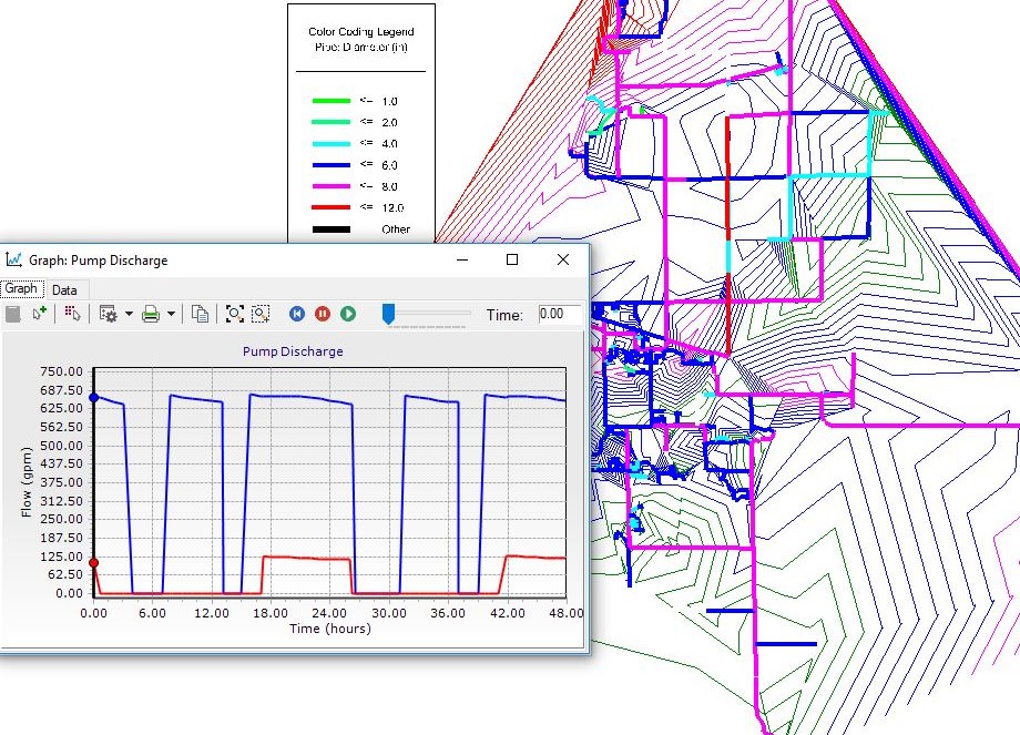
Requirements for a water system model
For a water distribution system hydraulic model to be created, a community needs to supply a few important details to the modeling team:
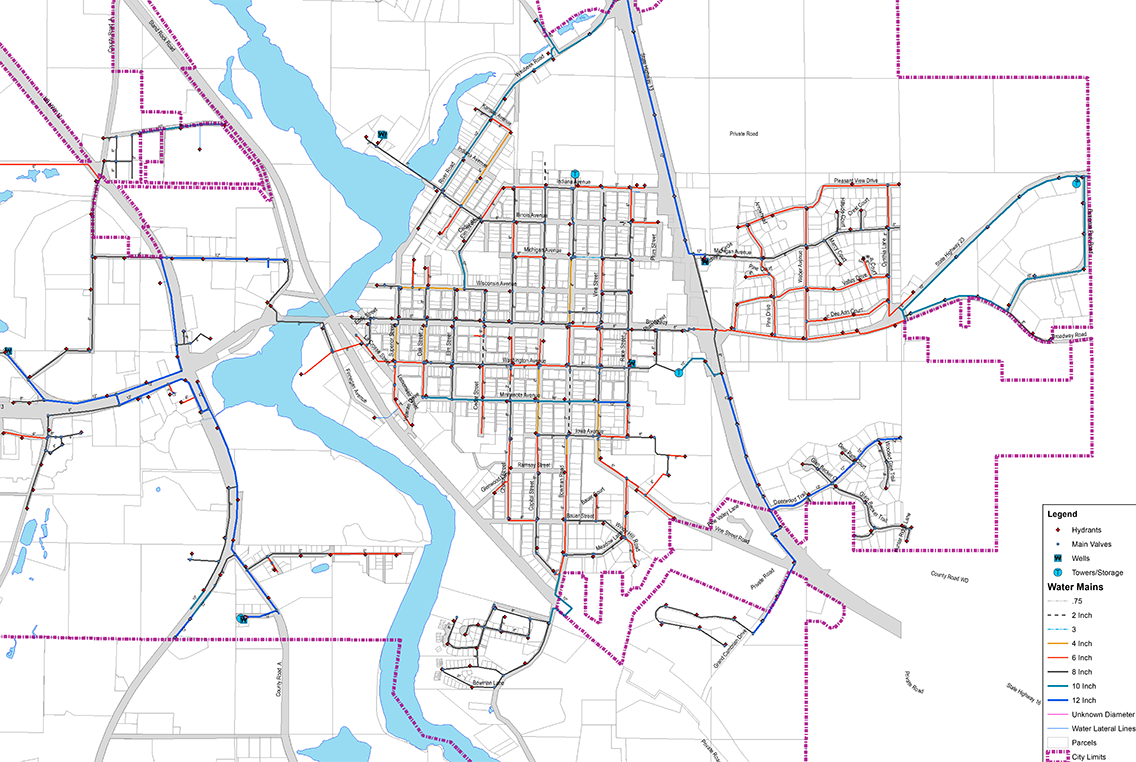
- Pipe locations, material and diameters
- Water source location and capacities
- Water storage location and capacities
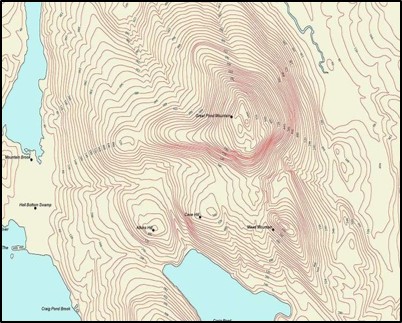
- Elevation data through LIDAR or GIS data collection
- Existing user demand data for residential, commercial and industrial users
- Hydrant fire flow tests and SCADA (Supervisory Control and Data Acquisition) system data for model calibration
- Future community growth plans for residential, commercial and industrial users
Creation of a comprehensive model
Once all the necessary information is gathered, a municipal engineer will analyze the provided data and conduct interviews with system operators. Data such as water main locations and attributes, locations of water storage tanks and pumps, along with elevation data will then be imported into the water modeling software. The software will then be used to begin testing the real-time hydraulic model and perform model calibration through the use of hydrant fire flow testing and comparison with the provided SCADA data. The output model results can include a number of deliverables: water distribution system static and demand pressures and fire flow availability maps, pump discharge and tank level graphs and simulated future improvement scenarios. The hydraulic model can easily take into account a community’s future water demand, and then their future system capacity requirements can be simulated accordingly in order to provide a clear picture of how their system may function in the future with anticipated growth. The water model’s greatest strength is the ability to easily compare infrastructure improvement options in the planning stage.
GIS for improved accuracy
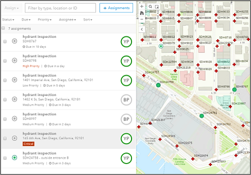
Hydraulic water system modeling is not a static endeavor. Data changes daily, as does the condition of system infrastructure. Creation of a model serves as a baseline for planning, but should be supplemented by ongoing input of information as aided by geographic information systems (GIS).
Here, GIS can be used for three important strategies in the field: inventory, inspection and classification. A community or utility will be able to keep their finger on the pulse of system component age and condition and can assign a rating number related to the level of functionality or concern based on observations performed on site. This is what is referred to as dynamic GIS. By using cloud-based mobile applications, users are able to collect real-time information related to the state of operations in order to plan for a smart future and budget for maintenance or replacement. For example, a worker could document valve leaks, hydrant conditions or manhole inspections on the go, easily accessible and editable by other staff. Applying this mobile GIS data collection to an ArcGIS online platform could further increase a community’s ability to thoroughly assess conditions and properly plan for future needs. All new water system information gathered by staff, or through new developments or improvements, are incorporated real-time into both GIS and water models for up-to-date output data.
A water modeling project profile – Mt. Zion, Illinois
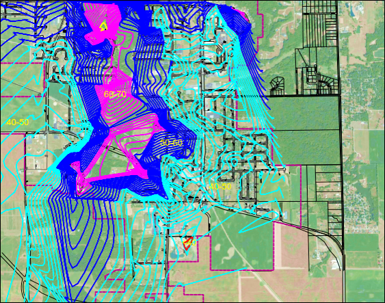
Model showing the existing static water pressure contours in Mt. Zion, Illinois.
At MSA, our municipal and water system engineers have developed computerized hydraulic models for water distribution systems for over 120 clients to date, helping municipalities continue providing clean, safe and reliable water to their residents.
Case study: Village of Mt. Zion, Illinois. Mt. Zion is a small community with a population of approximately 5,800 that had been purchasing its water in bulk from the neighboring City of Decatur. A single, undersized elevated water storage tank and underdeveloped water distribution system resulted in low system-wide water pressures and sporadic, depleted flow rates.

Model showing proposed static water pressure contours in Mt. Zion, Illinois.
The Village requested an engineering analysis of their water distribution system. Through the use of a GIS-integrated hydraulic water model, MSA performed an analysis of Mt. Zion’s water distribution system, simulating multiple scenarios to evaluate a new elevated storage tank location and capacity, water main upgrades, booster pump station flow rates, water source pressure variations and options. This model allowed the community to comprehensively plan for system upgrades, with recommendations that resulted in the construction of a new 1-million-gallon elevated storage tank, new booster station, and water main up-sizing and looping. The improvements yielded an immense increase in water storage, fire flow availability and overall system pressure, improved chlorine residuals, expanded capacity for anticipated growth and also the ability to use the hydraulic model in the future for capital improvement scenarios.
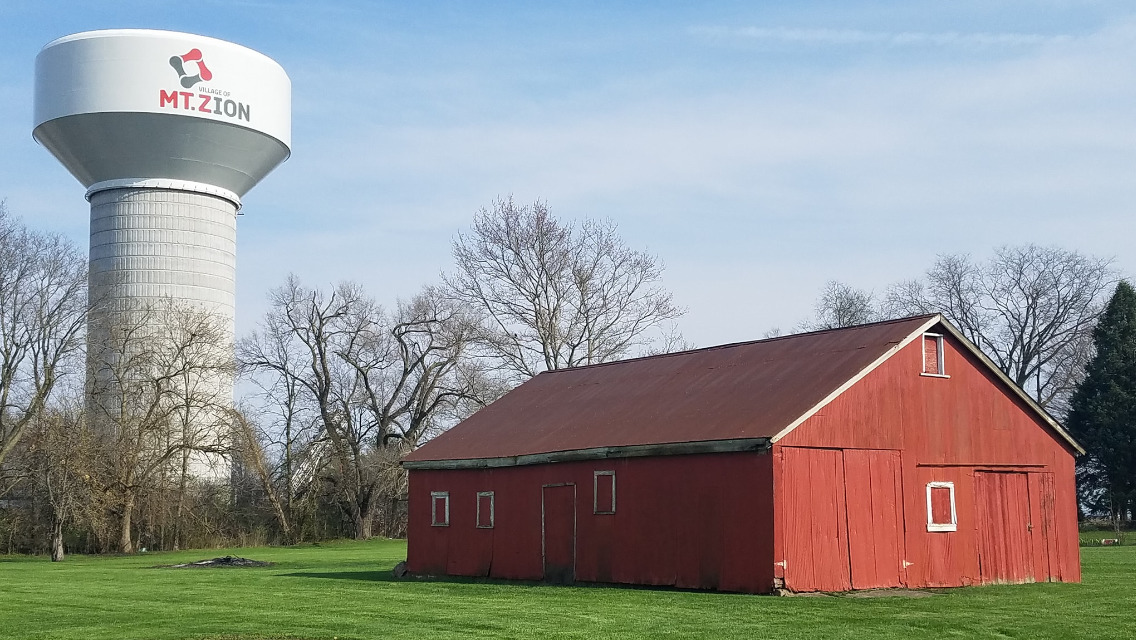
Residents rely on municipalities for access to a clean, safe and reliable water supply systems. We’re proud to develop water distribution system models that allow communities to analyze existing infrastructure and efficiently plan for the water systems of their future. Interested in learning more? Start a conversation with MSA’s water experts today.
