Have you ever wished a tedious task could be completed more efficiently and effectively? Often, it can! GIS tools can make workflows better, and not just for GIS staff.
There is no shortage of GIS applications and solutions that can assist engineers, field staff, clerks, budgeting personnel, city planners, public works and parks departments gather, synthesize and capitalize on community assets.
The world of GIS is changing daily. Communities are embracing these changing technologies as vehicles for efficiency—moving away from paper maps to online systems, leveraging the power of data analytics to plan for the future, and managing mapping on mobile devices to expedite decision-making. Here are just some of the ways GIS can help communities work smarter.
Task automation
We often hear clients bemoaning time-consuming tasks and wishing they would disappear. These tasks, completed on a regular basis, use up valuable staff time and mental energy. Using GIS automation, more can be done with less. Setting up simple computer scripts or webhooks allows processes to be seamlessly repeated whenever they are needed. A GIS analyst can learn the details of daily processes and develop specific systems to run those processes for you. If you’ve ever found yourself wondering, “Could we use GIS to…,” the answer is likely, “Yes!”
Modeling utility systems

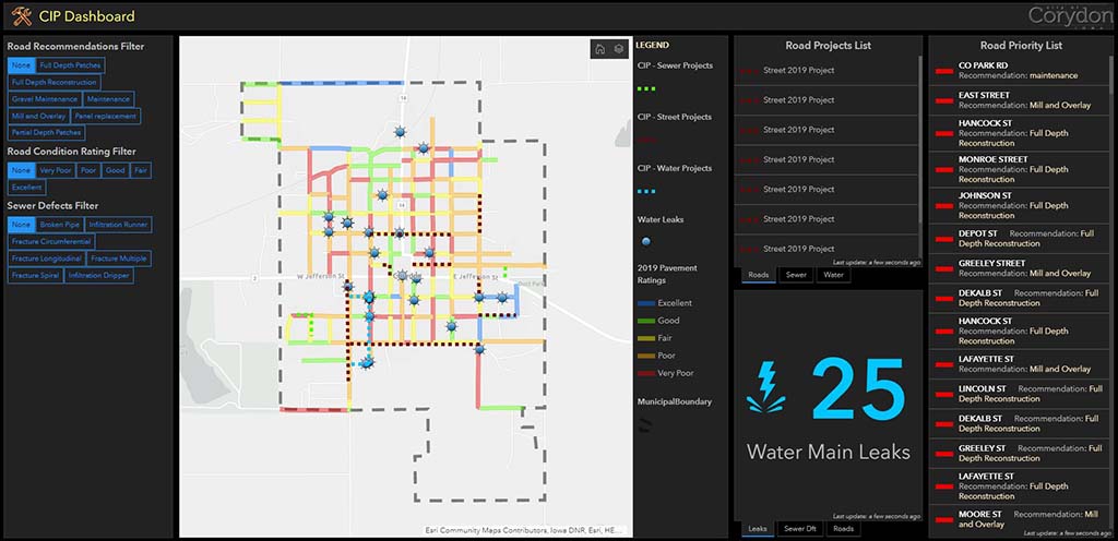
Many communities are largely unaware of where existing utilities lie or what condition they are in. This can leave municipal leaders and public works departments succumbing to a fail-patch-fail cycle of repairs that can render utilities unreliable and leave budgets on shaky ground. It can also make planning for the future much more difficult. Questions such as, “Where is our municipality anticipating growth and will our infrastructure support that growth?” and, “Are there any parts of our system that could fail in the near future?” are good common starting points. Next is identifying the best way to prioritize areas that need improvement while also taking into account things like timing and cost. GIS can be the solution.
GIS can be utilized to develop stormwater, potable water and sanitary modeling inputs. Using hydraulic and hydrologic software such as XPSWMM, a GIS professional can create powerful 2D models for utility networks to identify location, detect potential problem areas and assist in building a comprehensive asset management system that can be tied into future budgeting efforts.
GIS first steps
Perhaps your community doesn’t have a GIS system yet. No sweat. You are probably still sitting on a great foundation of information to get started. Experienced municipal staff and long-standing public works team members often have a wealth of community-specific information in their heads. Some simple conversations or a peek into the archives of a community’s paper maps can easily translate into the development of a GIS system. Even meager amounts of input can yield great results.

Perhaps you don’t know where your utilities are, but you have a staff member who’s been working in your community for 20+ years. Leverage that information! Asking that individual to sketch out the known utility system from memory can translate knowledge into a digital format. From here, a GIS professional can help acquire GPS locations of utility assets, or can train community staff on how to purchase and operate their own GPS device. Incorporating new technologies like mobile LiDAR can complete large-scale asset collection in a fraction of the time of traditional methods. As staff members retire, a community may also want to have a digital record of their insights. GIS is the perfect tool for recording all of that information.
Mobile work orders
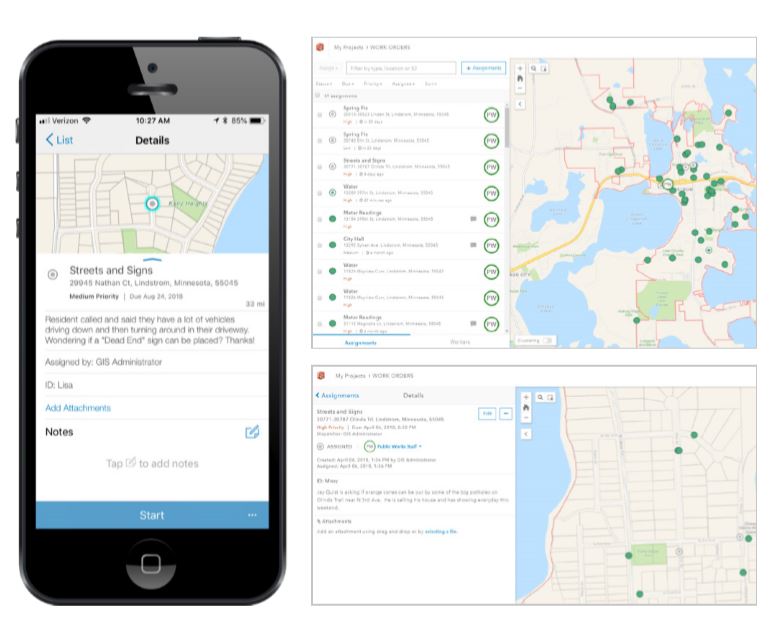
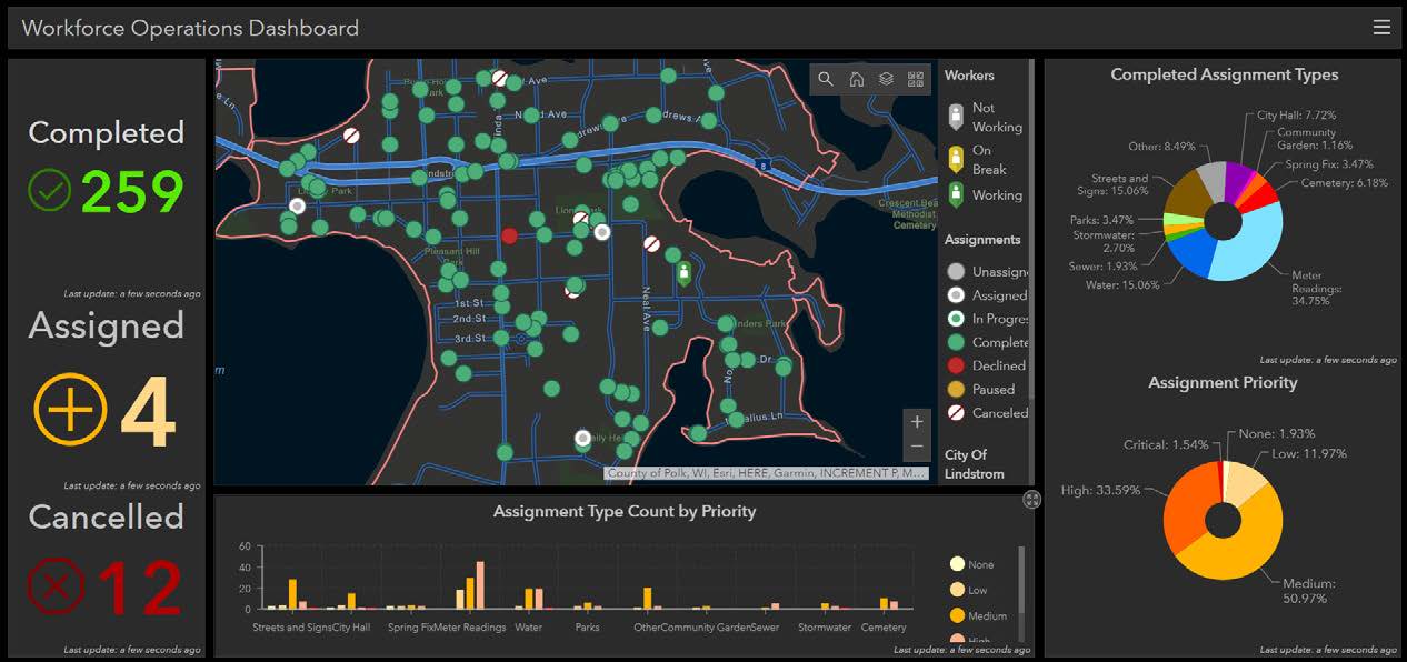
Field staff need to know what activities are on their plate each day, management needs to know when tasks have been completed, and financial planning staff need to know the time and costs associated with regular maintenance of existing city infrastructure. GIS offers an amazing solution to each of these needs: work orders. Using a GIS work order application, tasks are assigned to individual team members, with pertinent information about the location, type of project and timeline for completion. Managers can see what tasks are still outstanding and budgeting staff can view all the historical data necessary to complete data analytics, yielding a more holistic understanding of workload needs for future planning.

All of the other conveniences you would come to expect from modern software is included in the work order process: attaching pictures, time-stamping and device compatibility. Work order solutions can be customized for specific staff needs and delivered in a mobile format that is user-friendly, effective, and helps reduce administrative workload! We call that a triple win.
Work smarter
MSA uses GIS to improve how organizations operate, enabling everyone to reap the positive impacts of working smarter, not harder. We love coordinating with communities to make sure that collective knowledge is propagated into the future and have helped over 90 communities adopt a level of GIS that works for them. With modular, integrated solutions, communities can truly choose their own GIS adventure and will enjoy where that exploration brings them: beyond the perimeter of the map.
Whether you’re building your system from scratch or looking to unlock your existing system’s greatest potential, MSA’s GIS specialists are here to assist. Get the ball rolling with a GIS demo today!
