Out with the 1950s
The Grant County Highway Department determined the distressed roadway and sharply curved alignment of a one-mile segment of CTH K was in need of an improvement project. This project needed to replace two structurally deficient and narrow highway structures as well as one dairy farm entrance stream crossing. The project is located in the Town of Mount Ida in the driftless region of southwest Wisconsin. The highway wound through sensitive natural areas at the headwaters of the spring-fed Branch of the Big Green River, a tributary to the prized trout waters of the Big Green River. Midway through the project were major springs that fed the branch.

The first more upstream structure on CTH K, an antiquated and obsolete twin cell concrete box culvert with a narrow roadway, crossed the branch upstream of the major springs. Adjacent to this structure was a dairy farm entrance with a deficient structure crossing a tributary to the branch. At both sites, the streambed was normally dry. A half mile downstream, natural springs feed the branch, making it a cold water, continuously flowing stream with occasional strips of wetland along its edges. Over this downstream reach, CTH K again crossed over the branch, this time with an aging narrow bridge—a single-span, steel deck girder structure that was built in 1950. Its crumbling concrete bridge deck was in a state of rapid deterioration, eventually requiring temporary steel plates to cover holes at the gutter lines. All of the concrete abutment wing walls were tipping outward and at risk of failure during flood stage. This bridge needed replacing before further deterioration occurred and before heavy freight or agricultural load crossing would be prohibited. Or, before the structure potentially washed out entirely. The roadway was also unsafe with limited sight distance due to sharp corners around rock cut bluffs, which limited visibility to the narrow 24-foot-wide bridge.
In with the new
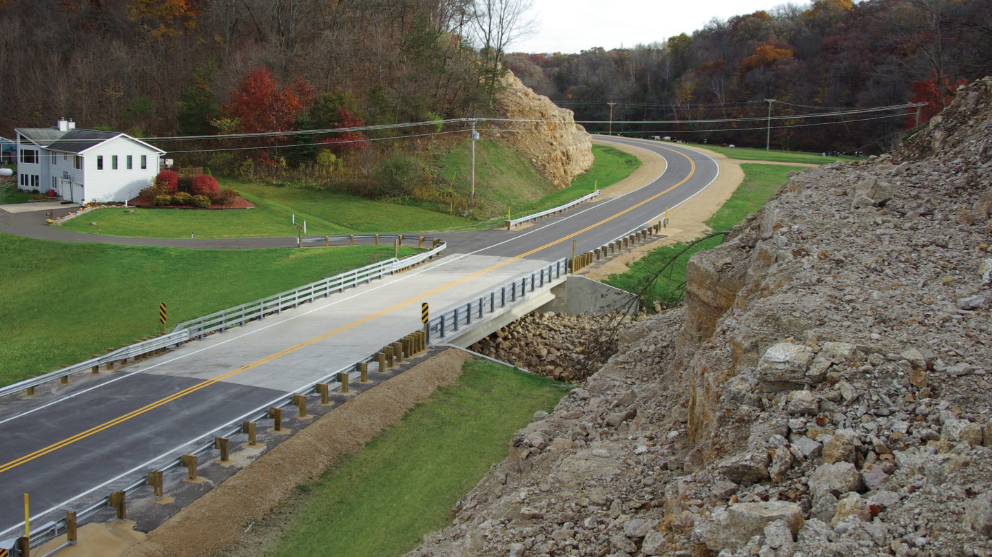
Grant County called on MSA to provide design services to correct these deficiencies and safety hazards. MSA designed one mile of new roadway on CTH K with an alignment allowing 50 mph traffic. To replace the upper branch crossing, the design included a new twin cell reinforced concrete box culvert on the highway and a new single cell box culvert for the dairy entrance. These structure types were the most economical for the normally dry streambeds. Also designed for the downstream cold-water site was a new 78-foot long, single-span pre-stressed concrete girder bridge with an expanded roadway width of 30 feet. This new span will accommodate a 100-year flood. It also avoided impacts to the wetlands along the stream edges and minimized other environmental impacts.
Safety and unobstructed sight lines
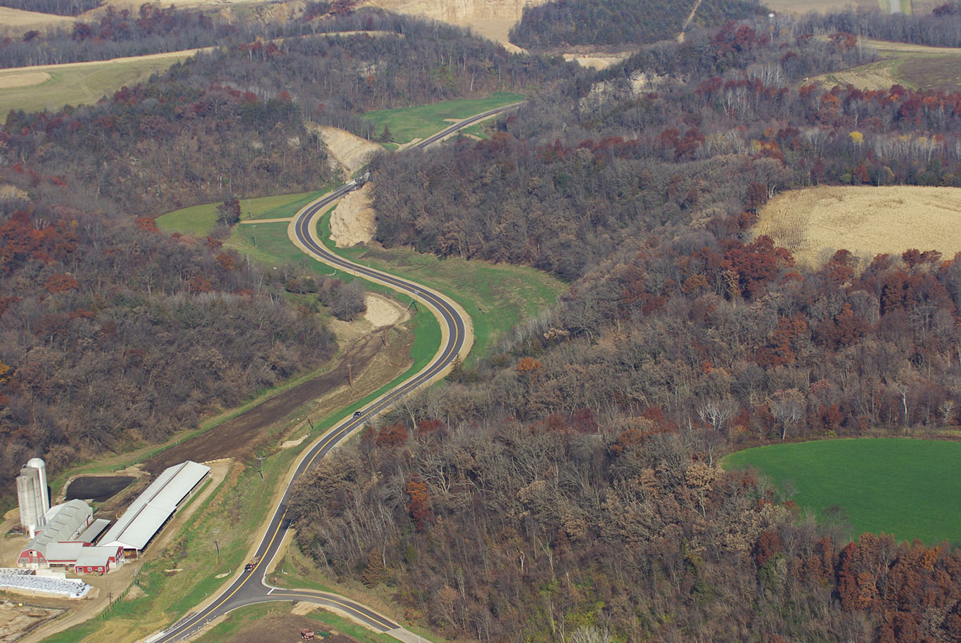
One of the challenges of the project was to realign the new widened and streamlined highway throughout a winding valley bounded by steep bluffs while continuing to provide access during construction to the dairy farm and residences located in the center of the project.
The alignment of the old road approaches at the cold-stream bridge included sharp 25 to 30 mph blind curves winding through narrow rock cut limestone bluffs—a safety concern with little stopping distance in a locale with much over-sized agricultural equipment and heavy truck traffic.
The newly designed highway addressed these issues by utilizing major rock cuts up to 90 feet deep to provide a 50 mph design speed alignment with excellent sight distance to the bridges. The project also squared up a busy town road intersection, improving safety and providing needed vision at the corners. The project also improved safety for access to the dairy farm. DNR protected land abutting the right of way was not impacted by the alignment, which provided expanded lines of sight in all directions, widened the roadway and provided a sound pavement structure using the excavated rock for a pavement subbase.
Clean water, healthy trout
An important goal of the project was to avoid detrimental impacts to wildlife and ecology in the vicinity of the Branch of the Big Green River. The major spring located midway within the project needed to be protected as it fed the branch, which provided consistent cold water that eventually drained to the Big Green River, a flourishing and prized trout stream.
Delving into a design and construction project through such an ecologically sensitive area would require an additional level of planning and competence. The Highway Department chose MSA for design of this project due to MSA’s expertise in designing roadways through environmentally sensitive areas as well as being familiar with MSA’s design and construction experience with multiple bridge types.
In coordination with the DNR and Grant County, MSA determined a best-fit alignment for the project in order to avoid the stream, surrounding wetlands and critical impact areas. MSA also implemented optimal erosion control methods to ensure zero contamination of the live waterway. Design details also ensured continual access to the dairy farm.
In the end, the most dangerous and winding segment of CTH K had been upgraded with a widened, streamlined rock solid pavement. Two deficient and obsolete stream crossings had been replaced with newly constructed bridges of types and sizes to provide the greatest economy and service life. The improved roadway, new intersection, structures and private entrances along CTH K created a safer, aesthetically pleasing, sustainable solution for local residents, farmers, wildlife and travelers.

