Dubuque, Iowa, is a go-to destination for adventurers and nature lovers. Surrounded by the county’s signature bluffs and perched alongside the Mississippi River, it is home to a wide variety of park and recreational amenities and attractions. In 2005, the City embarked upon a publicly engaged visioning process to plan for the future sustainable health and well-being of their community. The result of the process was the identification of a “Top 10” list of action items that would continue to meet the needs of residents and visitors and preserve the valuable natural resources the City was known for. One of the top action items defined was the creation of an integrated hiking, biking and walking trail system to encourage ongoing recreation and wellness.

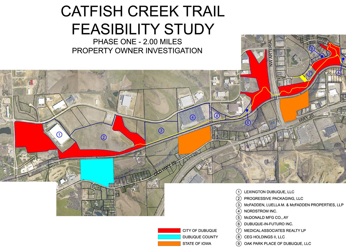
In 2008, Dubuque’s Leisure Services Department commissioned a feasibility study in cooperation with MSA. The study evaluated the Middle Fork of Catfish Creek and developed a concept trail design to test and determine whether it would “perform,” both practically and financially. Over the course of two years, and with input from the Park Commission, Trail Vision committee, affected property owners and City Staff, MSA further developed the study into a comprehensive evaluation of the entire stream corridor. This assessment provided the City with a planning-level document to guide them in the preservation, acquisition and development of public and private property in the area. It evaluated existing property ownership, topographic, environmental, roadway and railroad conflicts, identified wetland and flood plain locations and modeled preliminary hydraulic calculations for proposed stream crossings of Catfish Creek. Important consideration was also given to neighborhood access, trailhead location, user designations, ADA accessibility and maintenance costs.
After careful review, a preferred route and concept for the new trail was selected. The City chose the option that would best minimize cost, maximize use of City and State-owned property and create a constructible, traversable path, designed to be pursued in manageable phases as funding and land acquisition allowed. The planned trail will stretch 7.61 miles and cost an estimated $8,720,000, excluding land acquisition, trailhead amenities and vehicle-rated stream crossings.