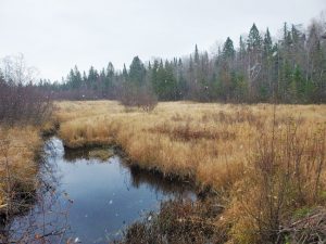
The Chequamegon-Nicolet National Forest covers over 1.5 million acres of water and woodlands in northern Wisconsin, spanning a total of 12 counties.
Legally defined as two separate national forests, the areas have been managed by the USDA Forest Service (USFS) as one conjoined unit since 1998, in close collaboration with the Wisconsin Department of Natural Resources (WDNR).

In 2020, the USFS and WDNR selected MSA for an expansive 5-year contract to inventory and document road and trail system waterway crossings within the national forest boundaries as well as in priority watersheds adjacent to Chequamegon-Nicolet lands. The ultimate scope of the project is to assess over 3,000 sites across four ranger districts — Bayfield, Washburn, Medford-Park Falls and Eagle River-Florence — to aid the DNR and Forest Service in identifying stream restoration project priorities.
MSA surveyors began the project in August 2020 focusing solely on the Bayfield ranger unit and expanded their geography in 2021 and 2022 to include Washburn, Medford-Park Falls and Eagle River-Florence districts. Each year, the DNR provides multiple new sets of priority waterway crossings to inventory, which has necessitated MSA surveyors in two-person crews from three different company locations to complete. The project begins each spring as soon as the ice melts, when water levels are safe, and runs until conditions freeze in the wintertime, providing crews safe access on the ice. Locations range from high-use roads and minimal maintenance roads to ATV trails and abandoned railroad grades, often requiring 4-wheel drive or access by foot.

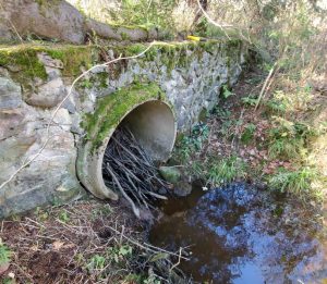
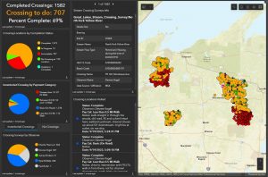
The inventory consists of assessing, measuring, photographing and digitally uploading via ArcGIS a wide variety of metrics at each waterway crossing utilizing the ArcGIS application, Survey 123. Some of the data collected includes: general site and stream identifications, crossing type (culvert, bridge, ford, dam), crossing shape and measurements, evaluation of structure-to-stream alignment and culvert skew, identification of outlet type, material and condition, stream flow information (banks, scour, sediment, erosion), assessment of stream flow conditions and water velocity, overall channel stability, and the dimensions and condition of adjoining roads, trails and embankments — all closely following methodologies set forth by the 2020 Great Lakes Road Stream Crossing Inventory manual.

ArcGIS helps streamline the process by creating maps for survey crew to utilize in the field, tracking project progress, as well as assisting project managers with staff management. Once collected, the data is uploaded to the cloud and accessible to the DNR and US Forest Service at any time, on any device — and is consistently synched in order to deliver project updates in real time.
Already, the Wisconsin DNR and Forest Service have been able to identify stream crossings that are top priority for replacement, and many of those replacements are currently in progress. When complete, the comprehensive evaluation of these 3,000+ crossings across the Chequamegon-Nicolet National Forest will aid forest managers in making smart, data-driven decisions about when, where and why to replace critical infrastructure — ultimately helping to preserve and protect the natural resources of this vast, wild space.
