The City of Lindstrom, Minnesota, has stepped forward as a leader in implementing GIS solutions for a variety of public works and capital improvement challenges. After many years of a fail-patch-fail approach to community road and street maintenance, City leaders recognized they needed a better system to budget for upcoming infrastructure improvements and track priorities and progress made.

Previously, the City’s public works staff would collect information about the condition of community roadways, but it was difficult to separate hard data from other socioeconomic factors and subjective opinions. Elements such as road type, safety, impacts to local neighborhoods, business districts and school zones all played a role in decision-making, yet these factors would often override the actual data. This slowed progress and muddied project prioritization.
The MSA GIS team built upon Lindstrom’s existing ArcGIS Online account to create a comprehensive three-pronged pavement management system. The system customizes ArcGIS Online apps to subjectively assess and manage the community’s pavement lifecycle.
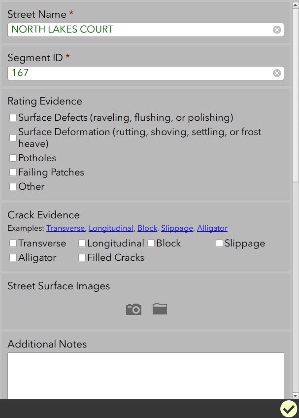
The first element is a pavement condition inspection mobile app. This is tailored for collecting data based on the PASER scale (1-10) developed by the University of Wisconsin-Madison. It harnesses computer algorithms to perform a weighted analysis of each pavement condition and suggests a pavement ratings based on physical observations. The workflow removes the subjectivity of ratings between staff members with varying levels of experience and personal opinions about priorities. The result is a single annual priority ranking number for each pavement component under review.

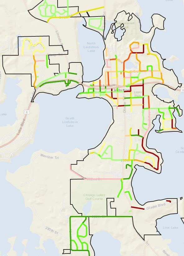
The second element is a pavement condition summary app which allows the user to view pavement conditions by colored segments and to filter by recommended road repair type, condition, etc. This map-based lens into any detail of a pavement segment allows managers to start identifying potential areas for contiguous road projects, compare utility conditions underneath roadways, and evaluate performance of a given rehab method over multiple years.
The third element is a criticality scoring matrix which cross-analyzes variables such as road safety, traffic volume, city districts served, etc. Data plugged into this matrix, combined with the condition ranking number from the pavement condition assessment app, results in an overall “City Priority Rank.” This additional step of ranking assists managers by allowing roads with priority beyond condition to clearly resolve into view, ensuring the most critical infrastructure is not ignored during planning. This multi-variable decision-making is ultimately how project decisions are made, and having this GIS approach to aid in that difficult process can simplify the whole process.
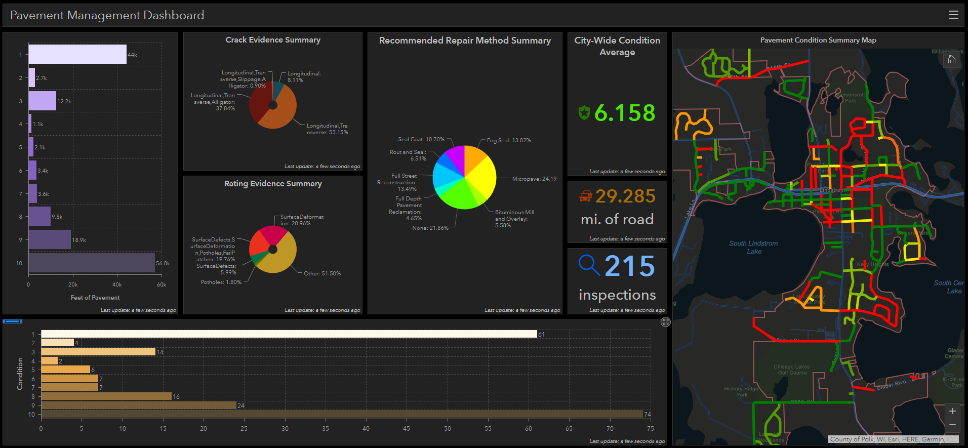
Once annual inspections are complete, a city street priority rank map and pavement summary dashboard provide comprehensive visual and tabular reporting of the results. From these results, the City of Lindstrom is able to identify top City Priority Rank projects to help guide their capital planning efforts and move efficiently forward with necessary repairs.

Whether you’re building your system from scratch or looking to unlock your existing system’s greatest potential, MSA’s GIS specialists are here to assist. Get the ball rolling with a GIS demo today!
