Efficient, effective child protection
There are many ways to support and strengthen communities. Helping to protect the well-being of our children is one of the most important.
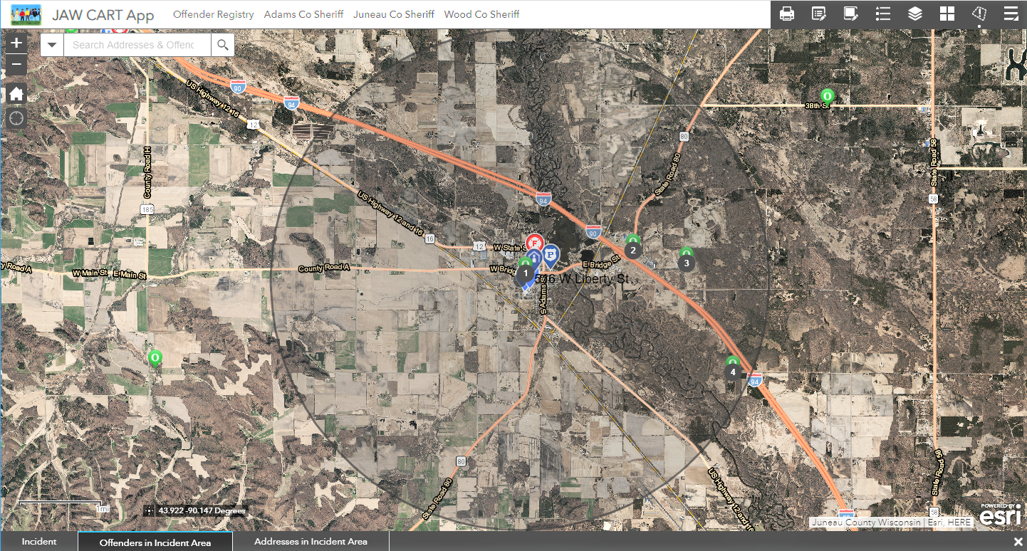
MSA configured an operations response GIS app for the Juneau, Adams and Wood County Child Abduction Response Team (CART) in south-central Wisconsin, created to aid in recovery efforts in the event of a child abduction situation.

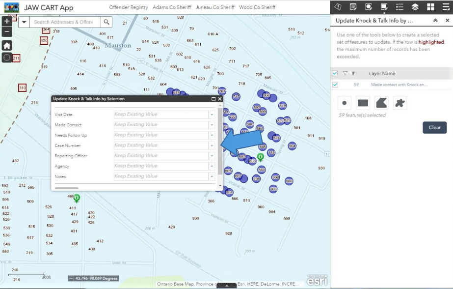
This Child Abduction Recovery App can be used by emergency response teams to map all aspects of the search and recovery operation. It uses a situational awareness widget to locate points of interest within a distance of a specified location, like where the child was last seen. The widget can highlight areas to guide canvassing teams and track the information they gain. It can also display addresses of people on the state offender registry and information about them, like tattoos, scars or other identifiable markings, as well as alias names used and vehicles driven. Investigators use the app to map search areas, evidence or other points of interest that may help lead to the recovery of a missing child. The app provides a complete view of the search and recovery operation to all team members in real time while also providing a map-centric record.
The app is designed to be easy-to-use and intuitive for non-GIS experts, providing digestible information for situations that require immediate attention. It will work on any device with an internet connection, whether that be a computer in the command center, a laptop in a squad car or a smartphone in the field. The app is a configuration of the Web AppBuilder for ArcGIS that can be deployed by any law enforcement, emergency management or response organizations who are charged with bringing an abducted child home safely.

Preparation in the field
MSA worked closely with Juneau, Adams and Wood officials and public safety officers to define best practices for use of the app. On September 19, 2018, the Child Abduction Response Team (CART) hosted a full-scale child abduction response training exercise near Wisconsin Dells, Wisconsin. The purpose of the exercise was to acclimate potential users to the capabilities of the app in tandem with scenario-related training about incident structure, documentation, communication, volunteer coordination and search and rescue.
MSA Professional services provides nimble GIS solutions for any number of municipal projects, from mapping and managing infrastructure assets to public safety and the protection of our children.
A trusted Esri partner
MSA has been a part of the Esri Partner Network—a worldwide community of companies that develop and deliver ArcGIS mapping solutions—for the past 15 years. The first firm in Wisconsin with Esri ArcGIS Online Specialty status, MSA has become a proven Esri Partner Network member and has developed a set of valued-added services and solutions to help municipalities implement and optimize ArcGIS Online in their organizations.
