At first glance, cemetery management would appear to be a very straightforward process with minimal requirements. Manage plot sales and maintain the cemetery with routine landscaping efforts–pretty simple, right? In actuality, the management of burial and grave information can be quite complex.
Unlike real estate records that are recorded and tracked formally at the county level through documented procedures, the rules managing burials have evolved without the benefit of quality documentation–creating many challenges for modern-day cemetery managers. In older cemeteries, there has been a simple lack of consistent record-keeping over time. This is further complicated by spatial issues: boundaries not fitting the grave site locations or managers using older legacy database systems and spreadsheets that are missing the spatial links necessary to accurately track records. Inconsistent terminology also adds confusion. Terms such as plots, lots, burial and grave sites can vary regionally. In some cases, they mean the same thing, other times not.

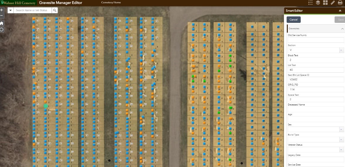
Walnut Hill Cemetery in Baraboo, Wisconsin, faced all these challenges–with a lack of mapping and a legacy database system that took hundreds of hours to populate. Typically, a project like this would start with some type of field inventory: painstakingly collecting headstone names, critical dates and veteran status information. At Walnut Hill, the MSA GIS team was able to extract the cemetery’s old legacy database records, eliminating the need to start from scratch with entry. While minimizing the data entry effort was successful, a challenge remained: build out the reference map without the benefit of field work, create a link to the converted database and then develop a solution that the Walnut Hill staff could continue to use for this important ongoing community work.
MSA utilized Esri ArcGIS Pro Desktop software for the task. This provided a number of tools that significantly improved the base layer drafting process and helped automate the numerous lot geometries. Once polygons were developed for each cemetery section, block and lot, the team then worked through the process of attribution, followed by the design of a unique gravesite ID system to successfully tie into the grave records.
The Esri ArcGIS Online cloud GIS platform was determined to provide the most affordable annual software cost for the cemetery association. It delivers the map component needed to most successfully manage grave information and the tools required to manage both existing grave records and the documentation of new gravesites. MSA was pleased to assist Walnut Hill with the implementation of the ArcGIS Online system, successfully recovering the old database records and developing a process to integrate each component into a holistic, low-cost solution for the cemetery association.

