“Golf is deceptively simple and endlessly complicated; it satisfies the soul and frustrates the intellect. It is at the same time rewarding and maddening – and it is, without a doubt, the greatest game mankind has ever invented.” – Arnold Palmer
A sophisticated evolution
The game of golf has been around for ages, with all the satisfactions and frustrations that accompany it. The modern version of the game originated in 15th Century Scotland, but many historians trace golf back to the Roman game of Paganica, in which participants used a bent stick to strike at a stuffed leather ball. Since then, the game has evolved into an international sensation, with over 34,000 courses occupying 85 percent of the countries on earth.
While basic elements of the game remain the same, the modern-day golf course has progressed from a simple swath of grass into an intricate and sophisticated landscape, perfectly engineered and manicured to host the highest level of competitive tournaments. These landscapes require an abundance of behind-the-scenes maintenance and infrastructure management in addition to the upkeep of a meticulous customer-facing appearance.
While golfers work on perpetually refining their swing, golf course superintendents work on preserving and enhancing the mechanics of the course as a whole.
Both can benefit from the introduction of GIS.
That’s right. GIS is stepping up to the tee box, offering apps, story maps and asset management capabilities to help players “up” their game and course superintendents optimize operations.
GIS for the competitive advantage
For golfers, GIS offers something unique—an at-your-fingertips virtual overview of the course itself—with guides and suggestions on how to best play each hole.
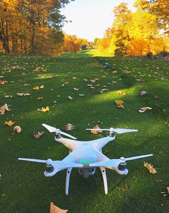
The MSA GIS team has paired up with the MSA Aerial Solutions team to create interactive story maps for golf courses. Here, an aerial/drone pilot performs fly-over work at a course and uses the captured footage to create an online tour, videos and images of the course. Golfers are then able to view the course story map of their choice either prior to playing, or while in the middle of a game. Hovering over a variety of features on the map provides detailed information about each hole, with course topography and layouts, hazards, fairway distances, par and handicap numbers. It may also provide pro tips about how to best approach each hole, with a variety of photos and/or videos to accompany.

Golf apps that stay the course
For golf course superintendents, GIS offers the real-time ability to collect, analyze, track and maintain golf course infrastructure.

The MSA GIS team has configured two golf-related apps based on the ArcGIS Online platform: the Golf Course Management app and the Course Collector Mobile app. The apps work in tandem to collect information about a variety of short- and long-term course operations. The apps can document information such as the installation dates of course irrigation systems and sprinkler heads, provide the ability to draw lines denoting the location of irrigation mains, logging of maintenance records and the opportunity to print maps of any scale from the application.
Out “in the field,” the course collector mobile app gives users the ability to collect and log course features, perform inspections, update locations and make measurements in conjunction with the mobile device’s GPS. Collected information might include inspection and repair dates for irrigation system components, hole number signage and condition reports, sprinkler system valve identification and assessment, tee box conditions, and the documentation of water main and water line names, diameters, lengths, and materials.
Once the superintendent has a solid grasp of course assets and a means to keep the course in tip-top shape, the addition of golf cart fleet management and cart path pavement management can dovetail directly into GIS as well, providing a one-stop shop for all the finer intricacies of running a golf course.
After data has been collected, the superintendent’s job becomes easier yet. Operations Reporting Dashboards provide instantaneous reporting metrics, statistics and graphics to tell the big picture story of all maintenance, repairs and operations. Because the superintendent is tracking maintenance through the dashboard, they’re also able to anticipate maintenance challenges or comply with such regulatory agency mandates as stormwater management.
Above-average, under-par solutions
MSA teams enjoy creating cost-effective ways to help people live, work and play better. GIS for golfers and golf course professionals is stepping up to improve the experience of this popular global pastime. Will your favorite local course be next?
Learn more about MSA’s GIS and Asset Management services, one of our recent unique app-building projects, our drone-based Aerial Solutions offerings and this golf course stormwater pond project in Beloit, Wisconsin.
Until then, keep your eye on the ball and stay out of the bunker.

